
This topic provides information on how to use markers in geographic series of the UltraGeographicMap™ control.
The following table lists the topics required as a prerequisite to understanding this topic.
This topic contains the following sections:
In the UltraGeographicMap control, markers are visual elements that display values of data items bound to geographic series in geographic locations of the map. Marker can be represented as labels, symbols or custom data templates.
The following types of geographic series support markers:
The following table maps the desired configuration to property settings of geographic series.
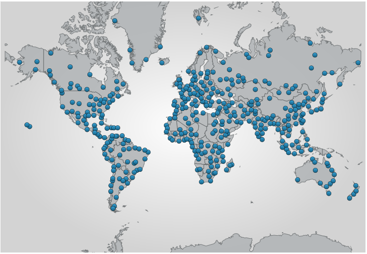
The screenshot below demonstrates how the UltraGeographicMap control looks as a result of the following settings:
The following code changes the appearance of markers in the GeographicSymbolSeries
In C#:
var geoSeries = new GeographicSymbolSeries();
geoSeries.DataSource = shapefileConverter;
geoSeries.MarkerBrush = new SolidBrush(Color.Blue);
geoSeries.MarkerOutline = new SolidBrush(Color.Black);
geoSeries.MarkerCollisionAvoidance = CollisionAvoidanceType.None;
geoSeries.LatitudeMemberPath = "Points[0][0].X";
geoSeries.LongitudeMemberPath = "Points[0][0].Y";
this.geoMap.Series.Add(geoSeries);
In VB:
Dim geoSeries = new GeographicSymbolSeries()
geoSeries.DataSource = shapefileConverter
geoSeries.MarkerBrush = new SolidBrush(Color.Blue)
geoSeries.MarkerOutline = new SolidBrush(Color.Black)
geoSeries.MarkerCollisionAvoidance = CollisionAvoidanceType.None
geoSeries.LatitudeMemberPath = "Points[0][0].X"
geoSeries.LongitudeMemberPath = "Points[0][0].Y"
Me.geoMap.Series.Add(geoSeries)The following topics provide additional information related to this topic.