
This topic provides information about supported types of geographic series in the UltraGeographicMap™ control.
The following table lists the topics required as a prerequisite to understanding this topic.
This topic contains the following sections:
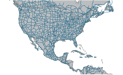
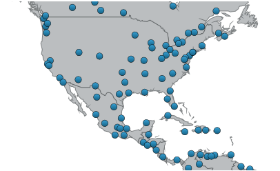
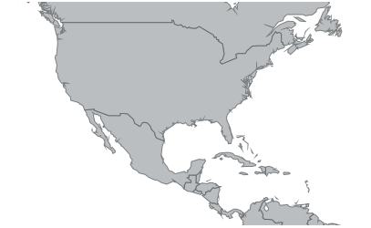
In the UltraGeographicMap control, geographic series are visual elements of the map that display geo-spatial data as points (e.g. locations of cities), polylines (e.g. road connections), or polygons (shape of countries) in a geographic context.
The UltraGeographicMap control’s Series property is a collection of geographic series objects. This property is used to support rendering an unlimited number of geographic series in the same plot area (refer to the Displaying Multiple Geographic Series topic). When multiple geographic series objects are added to the Series property, each successive series will be layered on top of the previous series starting from the first to the last series. Therefore, geographic series can be better understood as map layers that can be stacked on top of each other and/or on top of geographic imagery (refer to the Using Geographic Imagery topic).
The following table summarizes types of geographic series supported in the UltraGeographicMap control.
The following is a list of topics which provide task-based information on using individual types of geographic series and their unique features in the UltraGeographicMap control.
All types of geographic series are always rendered on top of the geographic imagery tiles. However, sometimes geographic series (e.g. with detailed shape files of the world) might provide enough geographic contexts for an application and geographic imagery is not desired in the UltraGeographicMap control. Refer to the Hiding Geographic Imagery in Map Background Content topic for information on how to hide the geographic imagery.
The code shows how to add the GeographicShapeSeries with the ShapefileConverter binding to the UltraGeographicMap control.
In Visual Basic:
' create and set data binding to the GeographicShapeSeries
Dim geoSeries = New GeographicShapeSeries()
geoSeries.DataSource = shapefileConverter
geoSeries.ShapeMemberPath = "Points"
' add the GeographicShapeSeries to the the UltraGeographicMap
Me.GeoMap.Series.Add(geoSeries)
In C#:
// create and set data binding to the GeographicShapeSeries
var geoSeries = new GeographicShapeSeries();
geoSeries.DataSource = shapefileConverter;
geoSeries.ShapeMemberPath = "Points";
// add the GeographicShapeSeries to the the UltraGeographicMap
this.GeoMap.Series.Add(geoSeries);The following topics provide additional information related to this topic.