
This topic provides information on how to hide geographic imagery in the background content of the UltraGeographicMap™ control.
The following table lists the topics required as a prerequisite to understanding this topic.
This topic contains the following sections:
By the default, the UltraGeographicMap control displays geographic imagery from the Open Street Maps in the map background content using the OpenStreetMapImagery class. However, there might be scenarios (for example, geographic shape series with detailed shape files of the world) where geo-spatial data from shape files provides enough geographic contexts and geographic imagery is not desired in the map background content.
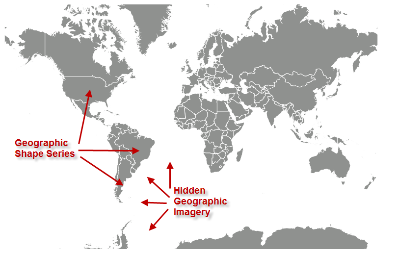
The following image is a preview of the UltraGeographicMap control with hidden geographic imagery in the map background content.
This code example hides geographic imagery by setting the UltraGeographicMap control’s BackgroundContent to a null value.
In Visual Basic:
Dim geoMap As New UltraGeographicMap()
Me.geoMap.SetImagery(Nothing)
In C#:
UltraGeographicMap geoMap = new UltraGeographicMap();
this.geoMap.SetImagery(null);The following topics provide additional information related to this topic.