
This topic provides information on how to use the GeographicPolylineSeries element in the UltraGeographicMap™ control.
The following table lists the topics required as a prerequisite to understanding this topic.
This topic contains the following sections:
In the control, the GeographicPolylineSeries is a visual map element that displays geo-spatial data using polylines in a geographic context. This type of geographic series is often used to render roads or connections between geographic locations such as cities or airports. The GeographicPolylineSeries works a lot like the GeographicShapeSeries except that geo-spatial data is rendered with polylines instead of polygons.
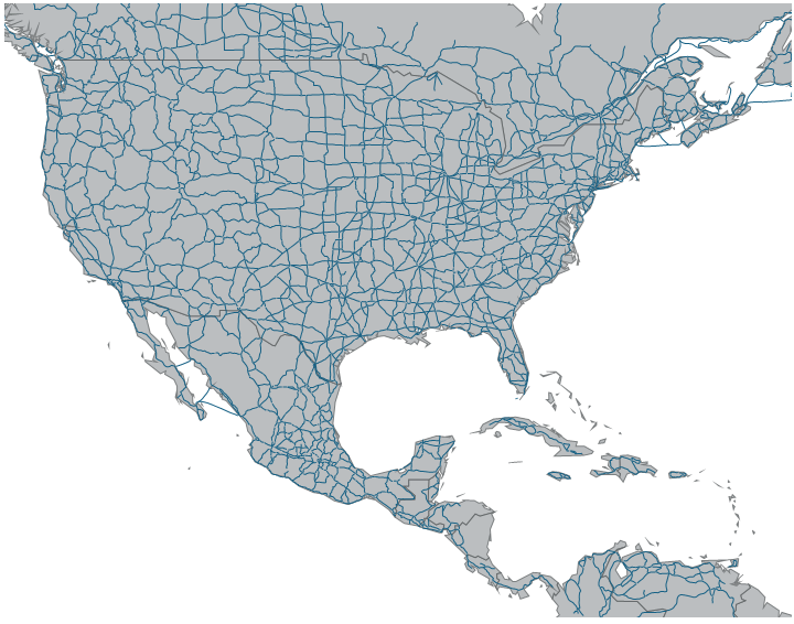
The following is a preview of the control with the GeographicPolylineSeries plotting roads in North America.
Similarly to other types of geographic series in the control, the GeographicPolylineSeries has the DataSource property for the purpose of data binding. This property can be bound to an object that implements the IEnumerable interface (e.g. List, Collection, Queue, Stack). In addition, each item in this object must have one data column that stores geographic locations (longitude and latitude) of connected items using the IEnumerable<Infragistics.Win.DataVisualization.Point> or IEnumerable<IEnumerable<Infragistics.Win.DataVisualization.Point>> structure. The latter is the standard data structure used by shape files and the ShapefileConverter object. This data column is then mapped to the ShapeMemberPath property. The GeographicPolylineSeries uses points of this mapped data column to plot polygons in the control.
The following code shows how to bind the GeographicPolylineSeries to locations of cities loaded from a shape file using the ShapefileConverter.
In Visual Basic:
' create and set data binding to the GeographicPolylineSeries
Dim geoSeries = New GeographicPolylineSeries()
geoSeries.DataSource = shapefileConverter
geoSeries.ShapeMemberPath = "Points"
' add the GeographicPolylineSeries to the the UltraGeographicMap
Me.GeoMap.Series.Add(geoSeries)
In C#:
// create and set data binding to the GeographicPolylineSeries
var geoSeries = new GeographicPolylineSeries();
geoSeries.DataSource = shapefileConverter;
geoSeries.ShapeMemberPath = "Points";
// add the GeographicPolylineSeries to the the UltraGeographicMap
this.GeoMap.Series.Add(geoSeries);The following topics provide additional information related to this topic.