
This topic provides information on how to display geographic imagery from Open Street Maps in the background content of the UltraGeographicMap™ control.
The following table lists the topics required as a prerequisite to understanding this topic.
This topic contains the following sections:
The Open Street Maps is a free geographic imagery mapping service created collaboratively by OpenStreetMap© contributors from around the world. It provides geographic imagery tiles of the world only in road map style without any configuration options. This geographic imagery service can be accessed directly on www.openstreetmap.org web site.
By the default, the UltraGeographicMap control displays geographic imagery from the Open Street Maps in the map background content using the OpenStreetMapImagery class. Therefore, there is no need to configure the control to display geographic imagery from the Open Street Maps.
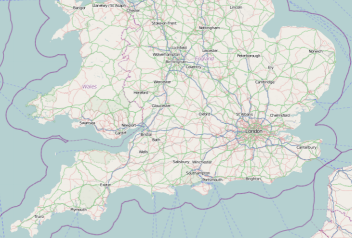
The following image is a preview of the UltraGeographicMap control with geographic imagery tile from the Open Street Maps service.
This code example explicitly sets BackgroundContent of the UltraGeographicMap control to the OpenStreetMapImagery object which provides geographic imagery tile from the Open Street Maps.
In Visual Basic:
Dim geoMap As New UltraGeographicMap()
Me.geoMap.SetImagery(New OpenStreetMapImagery())
In C#:
UltraGeographicMap geoMap = new UltraGeographicMap();
this.GeoMap.SetImagery(New OpenStreetMapImagery());The following topics provide additional information related to this topic.